London Post Code
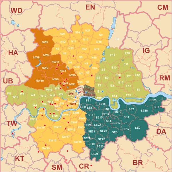
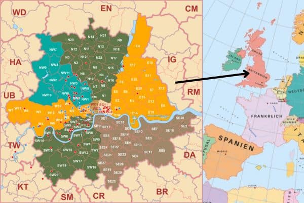
Here is the post code for london united kingdom post code. The Post code for london England are drawn by the abobe illustrator. The map shows the greater london and central london post code. The red cirle indicates the point of interest and blue circle also. The greenwich area is also shown in the map below the river.
The DA, BR, CR Sm, KT, TW, HA, RM, IG, CM, EN and WD county are also visible sorrounded the greter london. If you need those area we can draw the map for you. The post code of those area aslo ok for you. We draw this based on the freelance work. This map is the customized work.
Our services includes to draw th United states map, Map of the world, Map of Bangladesh in the World map.
List of Post code for london england:
Greater and Central London Post Code as follows:
SW 20, Sw 19, SW 15, SW 14, SW 13, SW 5, etc
SE 21, SE 20, SE 6, etc
E1, E2, E3, E8, etc
N 20 , N21, N3 , N2 etc
NW2, NW6, NW10, NW 3 , NW11
W7, W13, W5, W3
Download the London Post Code Map
More Maps


