Natural Disasters in Bangladesh

The details of the natural disasters: The country has a unique hydrological regime (system). It has 230 rivers, of which 57 are international, Bangladesh in most cases being the lower riparian country. Of the three large transboundary river systems (Ganges, Brahmaputra, and Meghna), only 7% of their huge catchment areas lie in Bangladesh. The major rivers have a length of 500 to 2500 km and a width range from 1 km to 20 km, with very flat slopes.
The seasonal flooding regime has been characterized by means of inundation of the different land types, which have been divided into five categories, ranging from very low to high land. Except for high lands (which cover 29% of the country’s total area), all other types are subjected to flood inundation to different degrees. Excepting very low lands, human settlements can be found in all other land categories.
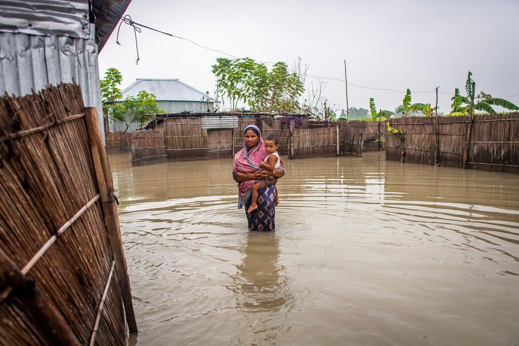
Bangladesh generally experiences four types of floods. Flash floods occur during mid-April before the on-set of the south-westerly monsoon. Rain-fed floods generally happen in the deltas in the south-western part of the country and are increasing in low-lying urban areas. River floods are the most common; the areas are inundated during monsoon season along the river and in cases far beyond the riverbanks.
Storm surge floods occur along with the coastal areas of Bangladesh, which has a coastline of about 800 km along the northern part of the Bay of Bengal. In the case of important cyclones, the entire coastal belt is flooded, sometimes causing great loss of lives. Coastal areas are also subjected to tidal flooding from June to September. During the last half-century, at least eight extreme flood events occurred affecting 50% of the land area.
These extreme events are generated by excessive rainfall in the catchments. When water levels in the three major river systems rise simultaneously and cross the danger marks (usually starting from mid-July and continuing until mid-September), an extreme flood situation usually occurs all over the country. The duration of these extreme events normally extends from 15 days to 45 days. This was observed during those which occurred in 1987, 1988 and 1998, the latter having been the severest one in terms of magnitude and duration.
Natural Disasters in Bangladesh: The River erosion
Erosion in Bangladesh is a regular and recurring phenomenon. Erosion of land surfaces, riverbanks, and coastal areas is already causing serious problems for the country. An increase in rainfall in summer is apprehended due to climate change, and this would in turn increase surface erosion.
Land erosion will intensify through current deforestation, and other land use practices (such as Jhum cultivation). Riverbank erosion is a serious problem in Bangladesh. It is a process largely controlled by river dynamics. The disruption in the life of many local communities is almost a continuous process, due to riverbank erosion, and the changing course of rivers. During floods, riverbank erosion becomes very acute, and leads to loss of valuable land.
Of equal if not more concern is the coastal erosion. Globally, 70 per cent of the world’s coastline has shown net erosion over the last few decades; less than 10 per cent has net degradation; and the remaining 20 per cent has remained relatively stable. Erosion in the coastal regions of Bangladesh is caused by a number of factors, such as high monsoon wind, waves, and currents, strong tidal actions, and storm surges (Ali, 2000).
Natural Disasters in Bangladesh: Nature of Cyclones

Cyclone and storm surges occur frequently and cause significant destruction in the coastal areas of the country. Nor’westers and tornadoes also frequently hit different places. Tropical cyclones and tornadoes uproot trees, telephone, telegraph and electricity lines, destroy bridges, culverts, and houses, kill people and domestic animals, leaving serious and adverse effects on the economy as well as on the whole environment.
Cyclones can cause immense loss of life and destruction of property during pre-monsoon (April-May), and post-monsoon (October-November.) periods. The Bay of Bengal is the breeding place of catastrophic cyclones. It is presumed that the Inter-Tropical Convergence Zone (ITCZ), which is situated near the equator, and where winds from the two hemispheres meet, plays a vital part in the formation of the tropical cyclones in this area. Cyclones in the Indo-Bangladesh-Pakistan subcontinent are classified according to their intensity of wind speeds.
Tracks of cyclones in the Bay of Bengal show that normally cyclones at their initial stages move at a rate of 8-16 km/hour, and in their final stages at 24-32 km/hour, or even up to 48 km/hour. Tropical cyclones derive their energy from warm moisture of the sea and to sustain this energy, sea surface temperature needs to be at least 260C. While developing, tropical depression needs a continuing spiral inflow to supply momentum and water vapor to the spinning vortex (Crane 1988).
Natural Disasters in Bangladesh: Table-Depicts the nomenclature of cyclone.
Depression -winds up to 62 km/hour
Cyclonic -storm winds 63-87 km/hour
Severe cyclonic -storm winds 88-117 km/hour
Severe cyclonic storm of hurricane intensity-winds above 117 km/hour
Cyclones in the Bay of Bengal usually move northwest in the beginning, and then gradually re-curve to move northeastwards, but this pattern is not uniformly followed. The cyclones usually decay after crossing land, causing colossal losses to life and damages to property in the coastal region. Heavy rains accompanying cyclones, and the tidal waves due to wind effects, called storm surges, cause most of the damages. Storm surge heights are directly related to cyclone intensity. Besides that, coastal configurations and bathymetry are also related to surge heights at the time of cyclone landfall.
Astronomical tides in combination with storm surges lead to further amplification of surge heights, resulting in severe flooding. An average of 1-3 severe to moderate cyclonic storms hit Bangladesh each year, with associated storm surges as much as 13 meters higher than normal in extreme cases, which can reach as far as 200 km inland (Milliman et al. 1989).
Natural Disasters in Bangladesh:Nature of Drought

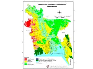
In agricultural context drought affects the rice production most. Due to drought severity, crop loss ranges between 20->60 per cent for T. Aman and other rice varieties (Iqbal, 2000). It is one of the most insidious causes of human misery.
Basically, there are three types of droughts:
· Permanent drought characterizes regions with the driest climate, having sparse vegetation that is adapted to aridity. Agriculture cannot be practiced without irrigation.
· Seasonal drought occurs due to rainfall shortage in places where there are well-defined annual rainy and dry seasons.
· Unpredictable drought involves an abnormal rainfall failure, mostly in localized areas of humid and sub-humid climate.
Drought conditions due to deficiency in rainfall affect different parts of Bangladesh mostly during the pre- monsoon and post-monsoon periods.
The natural disasters of Bangladesh: Nature of Abnormal Rainfall, Hailstorms and Lightning
Monsoon depressions that form in the Bay of Bengal move landward, and cause monsoon rain to be spread widely throughout the country. The mean annual rainfall in Bangladesh varies from about 1400 mm. in the western part of the country, to almost 5000 mm. in the northeast region. There are wide seasonal fluctuations, with about 90 per cent of the rainfall occurring during the four months of the monsoon period (June – September).
Monsoon depressions that form in the Bay of Bengal move landward, and cause monsoon rain to be spread widely throughout the country. Based on the area of formation, structure, intensity, and frequency of the monsoon depressions, the total rainfall during the monsoon period can be predicted. In spite of an overall abundance of rainfall during monsoon, at times serious rainfall shortage leads to droughts. It is not unusual for regions in Bangladesh to experience inadequate rainfall during the monsoon, while little rain during the dry season (October-March) is quite common, too.
A number of constraints are inherent in the monsoon rainfall, and climatic pattern. In addition, uncertainty in patterns of pre-monsoon showers, lightning, and hail cause a tremendous impact on human life, and agricultural production. The month-to-month and year-to-year variations in the atmospheric parameters like rainfall, temperature, humidity, etc., cause substantial variations in crop yields. Therefore, in Bangladesh the patterns of life and cultivation practices have traditionally been adapted to seasonal variability in climatic characteristics.
Natural Disasters in Bangladesh: Nor’westers and Tornadoes

The tornado forms within the Nor’wester, and moves along the direction of the squall of the mother storm. The frequency of Nor’westers usually reaches a maximum in April, whereas there are few in May, and minimum in March. Nor’westers and tornadoes are more frequent in the afternoon. Nor’westers may occur in late February due to early withdrawal of winter from areas. The occasional occurrence of Nor’westers in early June is due to delay in the onset of the southwest monsoon over the region (Karmakar, 1989).
Wind-speeds in Nor’westers usually do not exceed 113-130 km/hr (70-80 miles/hr), though often their speeds exceed 162 km/hr (100 miles/hr). When the winds become whirling with funnel shaped cloud having speed at several hundred kilometers or miles per hour, then they are termed tornadoes. Nor’westers brings much needed pre-monsoon rain. They can also cause a lot of havoc and destruction.
Tornadoes are suddenly formed and are extremely localized in nature and of brief duration. Thus, it is very difficult to locate them or forecast their occurrence with the present techniques available. However, high-resolution satellite pictures, suitable radar, and a network of densely spaced meteorological observatories could be useful for the prediction or warning of Nor’westers and tornadoes.
Natural Disasters in Bangladesh: Earthquakes

The north and northeastern parts of Bangladesh are the most active seismic zones, and had experienced earthquakes of moderate to high intensity in the past.
The great earthquake of 1897 had its epicenter in the Shillong Plateau of India, and caused widespread damage in adjacent areas of what was then known as Bengal. Two other major earthquakes that caused severe damage in areas adjacent to the epicenters were in 1885, known as the Bengal Earthquake, and in Srimangal in 1918. In addition, major earthquakes occurred in Bangladesh, and surrounding areas in the years 1833,
In 1885 earthquake change the River direction of Padma. 1897(magnitudes 8.1 In Dauki Fault Bangladesh and Kill 1542 in Bangladesh and India) 1906, 1918, 1923, 1926, 1927, 1930, 1934( magnitudes 8.3 in Bihar and Nepal bordar) 1939, 1941, 1943, 1947, 1950( magnitudes 8.6 in Asham) 1951, 1954, 1957, 1962, 1965, and 1988 (Karmakar, 1989). Earthquakes with magnitudes between 7.0 and 8.7 on the Richter scale have been experienced in this country, but they are rare events.
