Basic ArcGIS Training by PSTU ESDM Club Sign up soon
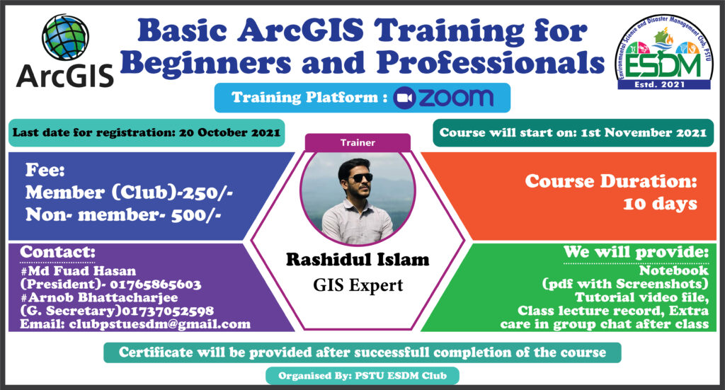
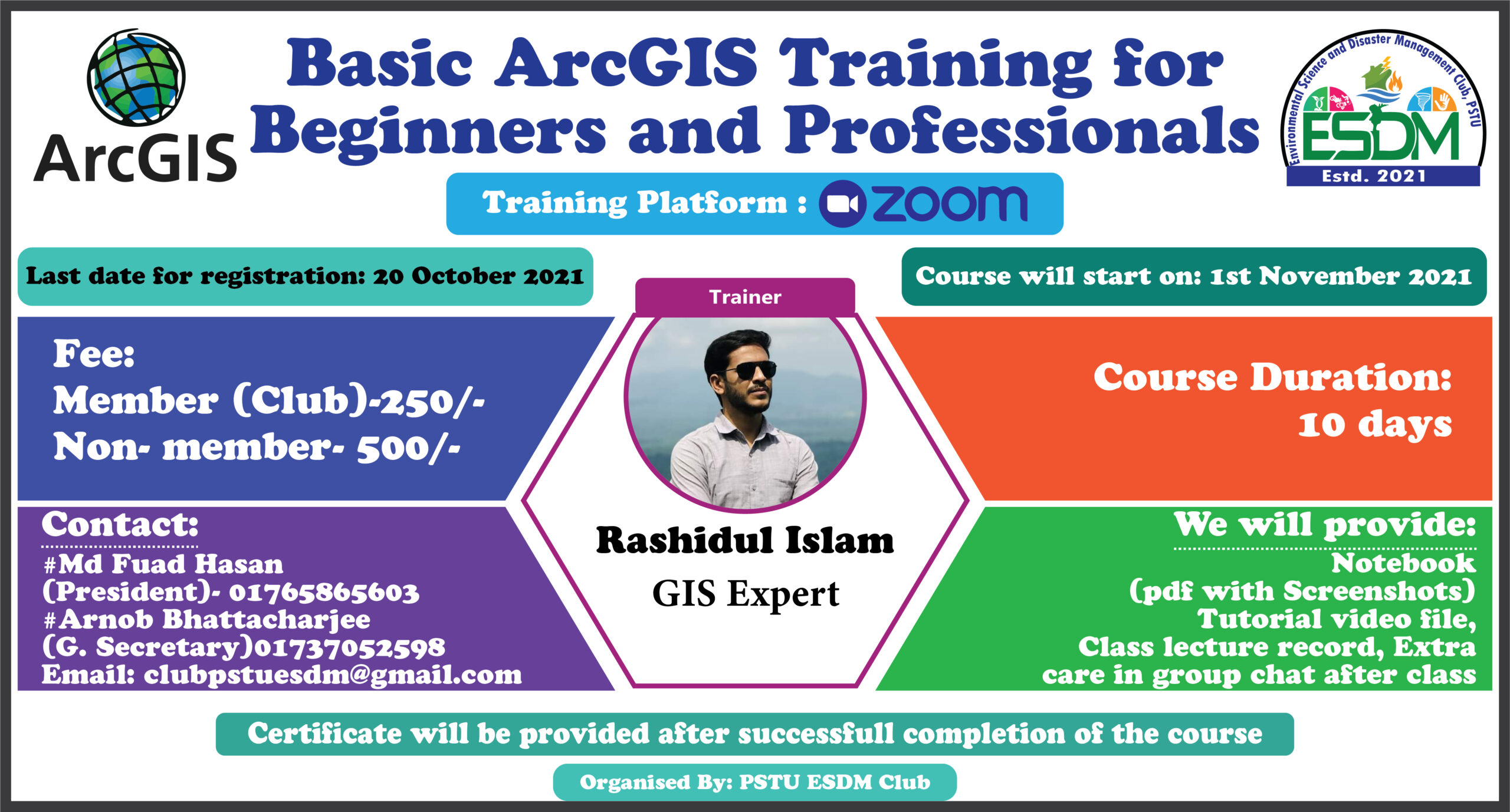
Greetings from PSTU ESDM Club. They are going to arrange the second part of Basic ArcGIS Training. Details are given in the following Facebook link and flyer. Please do registration as soon as possible as the last date for registration is 20th October 2021.
The fee for the registration is only 200 Tk (BDT) for those who already completed our first training during the period of 05 July to 02 August, 2021.
জিআইএস (Geographical Information Systems-GIS) ভৌগোলিক তথ্য ব্যবস্থা; ভূ-পৃষ্ঠের কোনো স্থান সম্পর্কিত উপাত্ত সংগ্রহ ও সংরক্ষণের জন্য গৃহীত প্রযুক্তি। এ প্রযুক্তি ব্যবহার করে মানচিত্র এবং উপগ্রহ চিত্রে উপস্থাপিত পারস্পরিক তথ্যের বিভিন্ন লেয়ার বা স্তর সহজ উপায়ে ব্যাখ্যা-বিশ্লেষণ করা যায় এবং এদের মধ্যকার পারস্পরিক সম্পর্ক নির্ণয় করা যায়।
বাংলাদেশে জিআইএস-এর ব্যবহার খুব সাম্প্রতিক হলেও বিভিন্ন ক্ষেত্রে এর ব্যবহার দ্রুত সম্প্রসারিত হচ্ছে। PSTU ESDM Club আয়োজিত Basic ArcGIS এর উপর গত ট্রেনিং সেশনে বাংলাদেশের ১৮ টি পাবলিক বিশ্ববিদ্যালয়, ৫ টি প্রাইভেট বিশ্ববিদ্যালয়, জাতীয় বিশ্ববিদ্যালয় এবং স্কুল ছাড়াও বিভিন্ন গবেষণা প্রতিষ্ঠান থেকে ১৩৫ জন ছাত্রছাত্রী, শিক্ষক এবং গবেষকগন অংশ নিয়ে ছিলেন।
তারই ধারাবাহিকতায় PSTU ESDM Club জিআইএস এর উপর ২য় ট্রেনিং সেশন আয়োজন করতে যাচ্ছে।
আগামী ০১ নভেম্বর হতে GIS এর উপর ১০ দিনের একটা ট্রেনিং প্রোগ্রাম আয়োজন করা হবে।
★উক্ত ওয়ার্কশপে যা যা শিখানো হবে:
Provide ArcGIS 10.6 with crack file (কারো 10.3-10.8 ইনস্টল করা থাকলেও চলবে)
How to Install ArcGIS 10.6Exercise 1: Vector layers basic
Add layers
Create a new layer (shapefile)
Working with editing tools
Attributes of the layers
Extract features
Changes the style of a layer using symbologyExercise 2: CRS and Google Earth Pro
CRS and PCRS Setup
Map projection in detail
Working with google earth pro
Conversion of kmz/kml filesExercise 3: Working with vector tools
Introduction to Geoprocessing tools (buffer, clip, intersect, union and merge)
Work with field calculator
Calculating the area: Open field calculator
Attribute table to excel
Excel to attribute tableExercise 4. Image download and working with raster data
Download Landsat image from USGS
Import the image in ArcMap
Work with raster processing (composite band, resample, split raster)
Extracting information from raster layers
Creating a slope map from DEMExercise 5: Working with spatial analyst tools
Interpolation
Creating contours
Raster reclassification
Area calculation of raster classesExercise 6: NDVI and Temperature measurements
NDVI calculation
Temperature Measurement from satellite imagesExercise 7. Map Visualization and File format
Create a map with Map Composer
Map package
ArcGIS online
★কোর্স সম্পর্কে বিস্তারিত :কোর্স অনলাইনে হবে (Zoom)। প্রতিদিন ১.৩০ ঘন্টা (রুটিনে গ্যাপ থাকবে) ক্লাস হবে (৩০ মিনিট প্রবলেম সলভিং)। প্রতিদিন ক্লাস শেষে চ্যাট গ্রুপে এক্সারসাইজ এবং ফিডব্যাক এর ব্যবস্থা থাকবে।কোর্স কমপ্লিট হবার পর ৩ দিন রিভিউ ক্লাস রাখা হবে।
সবাইকে নোটবুক প্রদান করা হবে যেখানে স্ক্রিনশর্ট আকারে থাকবে যা পরবর্তীতে বুঝতে সহজ হবে।এছাড়াও টিউটোরিয়াল ভিডিও এবং ক্লাস রেকর্ড প্রদান করা হবে।কোর্স সমাপনীতে সার্টিফিকেট বিতরণ করা হবে।
★কোর্স ফি:ক্লাবের মেম্বারদের জন্য- ২৫০ টাকানন-মেম্বারদের জন্য – ৫০০ টাকা
★রেজিস্ট্রেশন প্রক্রিয়া:নিচে সংযুক্ত গুগল ফর্মের মাধ্যমে রেজিষ্ট্রেশন করতে হবে।তার আগে রকেট,বিকাশ অথবা নগদ থেকে কোর্স ফি প্রদান করে ট্রানজেকশন আইডি গুগল ফর্মের নির্ধারিত বক্সে বসাতে হবে।রেজিষ্ট্রেশন শেষ হলে আমরা কনফার্মেশন মেইল পাঠাবো।
বিকাশ (পারশোনাল) – 01765865603নগদ – 01765865603রকেট – 017370525984
★যা থাকতে হবে কোর্সটি করার জন্য:নিজের অথবা পরিচিত কারো কম্পিউটার, নেট কানেকশন।রেজিস্টেশন লিংক:https://forms.gle/iVMwyG1rCdbSZ5kD9
Basic ArcGIS Training

Registration Link: https://forms.gle/iVMwyG1rCdbSZ5kD9Details of the registration process: https://web.facebook.com/permalink.php?story_fbid=1314101759044901&id=100013352687676
