Earthquake Measurer: How to measure the earthquake actual epicenter
Earthquake is one of the most common disasters in the recent world. Earthquake is not a recent disastrous event. It has a long history of occurrence. From the beginning of the earth’s formation earthquake is happening every day in a small or big magnitude.
The ancient people did not know the actual cause of the earthquake. The world is getting more knowledge and technology to explore natural events.
Uncivilized people think that earthquake is caused by God’s will. But recent technology proves that this is a natural process like as wind blows from east to west or west to east or north to south. This is so natural process happening throughout the world every day.
Scientists prove that most occurrences of earthquakes happen in the Ring of Fire. The ring of fire is the region where the earth’s crust is subducting or moving far away from each other.
Plate tectonics is the main cause of happening earthquakes. The theory of tectonics shows that the earth is made up of some land mass called plate. These plates are moving continuously very slowly.
The source of plate tectonic movement is the energy from the hot magma inside the earth. The plate movement works like a piece of paper moving on the boiling water in a glass.
The lifespan of human beings is so tiny that people cannot realize the movement of plates. The plate moves 10 cm per year on average.
Modern humans identify the location of the earthquake. Scientists developed a measuring technique called a seismograph. The recorded seismic wave on a piece of paper is called seismogram.
From the height of the seismic wave on a seismogram, we can identify the magnitude of the earthquake. Now the whole world is covered with earthquake-measuring seismographs. For each location, every seismograph detects some seismic wave from a specific earthquake.
These seismic waves tell us the actual location of the seismic source. The actual source of seismic waves is called the epicenter of the earthquake. If an earthquake happened then to get the actual location we need at least three seismograph data.
From each seismograph data, we can get a circle of the approximate location of the earthquake. Each circle then intersects at a specific point. The epicenter is the point of the actual location of the earthquake.
Earthquake Measurer: How to measure the earthquake actual epicenter
For details here is the picture to get the idea.

Earthquakes are a natural phenomenon that have captivated and terrified humanity for millennia. But how do we measure their size and potential impact? While the Richter scale is a familiar term, it’s not the whole story. Let’s delve deeper into the world of earthquake measurement and understand the science behind the shaking.
The Power of Ground Motion
Earthquakes occur when tectonic plates, massive slabs of the Earth’s crust, shift or collide. This sudden movement releases tremendous energy, creating vibrations that travel through the Earth as seismic waves. These waves cause the ground to move, and the intensity of that movement is what we experience as earthquake shaking.
Modified Mercalli vs Richter Scale:
For many, the Richter scale is synonymous with earthquake magnitude. Developed by Charles Richter in the 1930s, it assigns a numerical value based on the amplitude (intensity) of the largest recorded surface wave. While the Richter scale provided a valuable tool for initial earthquake classification, it has limitations.
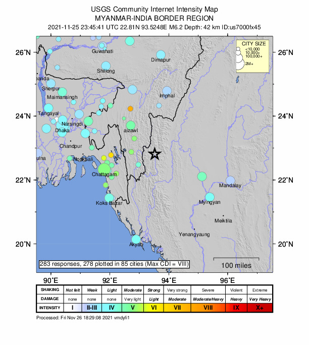
Modified Mercalli (MMI): This scale focuses on the effects of ground motion on people and structures. It uses a Roman numeral ranking system (I-XII) based on observed damage and human perception of shaking.
Enter the Moment Magnitude Scale
The Richter scale struggles with quantifying larger earthquakes. Geologists introduced the moment magnitude scale (Mw) in the 1970s. This scale considers the total energy released by the earthquake, providing a more accurate measure of its size, particularly for powerful events.
Seismic Stations:
A global network of seismic stations continuously monitor the Earth for ground motion. These stations record the seismic waves generated by earthquakes, allowing scientists to calculate the magnitude using both the Richter scale and the moment magnitude scale.
Earthquake Risk:
Earthquake magnitude is just one piece of the puzzle when assessing earthquake risk. Factors like location, depth, and local geology all influence the potential impact of an earthquake.
So, next time you hear about a large earthquake, remember that scientists have a sophisticated toolkit to measure its strength and assess the potential consequences. This knowledge is crucial for hazard mitigation, preparedness, and building resilience in earthquake-prone regions.
Read More on Earthquake: