Class Lecture on Geophysics
Assignments on Geophysics
Geophysics Defination:
is a branch of Earth science that employs the principles of physics to study the Earth’s physical properties and processes. It delves into the intricate workings of our planet, from its core to its atmosphere, to understand its composition, structure, and dynamics.
At its core, geophysics involves investigating the physical properties of the Earth, such as its density, magnetism, gravity, and elasticity. These properties provide crucial clues about the planet’s internal structure, including the composition and behavior of its core, mantle, and crust.
One of the most significant applications of geophysics lies in understanding plate tectonics, the theory that Earth’s outer shell is divided into several large and small plates that move relative to each other. This dynamic process shapes the Earth’s surface, giving rise to mountains, earthquakes, and volcanic activity. Geophysicists use various techniques, including seismic studies, to investigate plate movements and their impact on the planet.
Another crucial area of geophysics is the study of the geomagnetic field. Generated by the movement of molten iron in the Earth’s outer core, this invisible shield protects us from harmful solar radiation. By analyzing changes in the geomagnetic field, scientists can gain insights into the Earth’s internal processes and potential hazards like geomagnetic storms.
In essence, geophysics is a multifaceted discipline that provides a fundamental understanding of our planet. By applying the laws of physics to the Earth’s complex systems, geophysicists contribute to advancements in fields such as resource exploration, hazard assessment, and climate modeling.
Scopes of Geophysics: Where to Apply?
Geophysics plays a vital role in meeting the needs of society, such as mitigating natural disasters, protecting the environment as well as finding mineral resources.
Geophysics can be used in many fields such as Natural hazard studies,Resource exploration,Engineering,Environmental application. Natural hazard studies Geophysics studies earthquake. It understand past earthquakes and their impact on society.
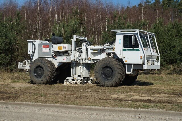
The minerals excavated are iron, copper, gold, silver, molybdenum, zinc, coal, uranium, sulfide, tin, chromite, potash, etc. geophysical methods are playing an important role in mineral investigation, groundwater investigation and hydrocarbon exploration.
Engineering Geophysical methods provide accurate data about the structure of the subsurface valuable information in the field of engineering. We gather non-destructive measurement data by means of airborne geophysics, along the earth’s surface as well as in or from tunnels and boreholes. It uses in Geophysical subsoil investigation to determine the layer model and the homogeneous areas.
Ground surveys and monitoring in areas prone to landslides, geological hazards and karst areas.Geological exploration of tunnel routes.Seismic exploration for tunnel driving.Borehole tomography for detailed exploration of the subsoil, e.g. in the foundation engineering of large structures.
Environmental application Geophysics is used to assess groundwater pollution and in monitoring changes in water quality and groundwater.
Geophysics can aid the investigation of pollution of the groundwater resource and of actual and potential pathways in the subsurface.
- Buried Waste Container and UST studies
- Groundwater Contaminant Plume Delineation
- Radioactive Waste Mapping
- Landfill Studies
- Karst Mapping
- Flow Pathway Studies
- Tracer Tests
- Sludge Thickness and Extent
- In-situ Aquifer Parameter Delineation
- Bedrock Fracture Studies
- Depth to Bedrock
- Stratiographic Mapping
- Phase II Environmental Site Assessments
- Borehole Fracture Identification
- Aquitard Mapping
Geophysics, the study of Earth’s physical properties using physics principles, offers a diverse range of applications across various fields. Here’s a breakdown of where you can apply your geophysics expertise:
Energy Sector:
- Oil and Gas Exploration: Geophysicists play a vital role in locating and characterizing potential oil and gas reserves. Techniques like seismic reflection and refraction are used to map underground structures and identify promising drilling targets.
- Renewable Energy: Geophysical surveys are crucial for geothermal exploration, assessing the potential of underground heat sources for geothermal power generation. They’re also used in wind farm development to evaluate subsurface conditions for wind turbine stability.
Environmental Geoscience:
- Hydrogeology: Geophysicists help locate and map groundwater resources, assessing water quantity and quality for sustainable water management. They also use their expertise in environmental remediation projects, characterizing subsurface contamination and monitoring clean-up efforts.
- Natural Hazard Mitigation: Geophysics helps identify areas prone to landslides, evaluate earthquake risks, and predict volcanic eruptions. This information is crucial for hazard mitigation strategies and infrastructure development in high-risk zones.
Mining and Mineral Exploration:
- Mineral Exploration: Geophysical techniques like gravity surveys, magnetic surveys, and electrical resistivity are used to explore for valuable minerals and metals like gold, copper, and uranium. These surveys help identify potential mineral deposits and guide targeted drilling activities.
- Geotechnical Engineering: Geophysicists contribute to geotechnical engineering projects by assessing the stability of foundations for buildings and infrastructure, identifying potential hazards like sinkholes or caverns.
Other Applications:
- Archaeology: Geophysical surveys can aid archaeologists in detecting and mapping buried structures and artifacts without extensive excavation. This helps preserve archaeological sites and gain insights into past civilizations.
- Space Exploration: Geophysical techniques are used to study the composition and structure of planets, moons, and asteroids. This provides valuable information about the formation and evolution of celestial bodies in our solar system.
Required Skills and Qualifications:
- A strong foundation in physics, mathematics, and geology is essential for a successful career in geophysics.
- Proficiency in computer modeling and data analysis is crucial for interpreting geophysical data.
- Excellent communication and collaboration skills are necessary when working with other engineers, scientists, and stakeholders.
Educational Paths:
- A bachelor’s degree in Geophysics, Geology, Physics, or Engineering provides a strong foundation.
- Pursuing a Master’s degree in Geophysics or a related field can enhance your expertise and career prospects in specific areas of application.
Overall, Geophysics offers a rewarding career path for those interested in applying scientific principles to explore Earth’s mysteries and solve real-world problems in various industries. The demand for skilled geophysicists is expected to grow in the coming years, particularly in sectors like renewable energy and environmental sustainability.
