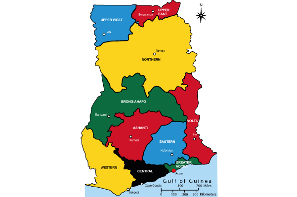
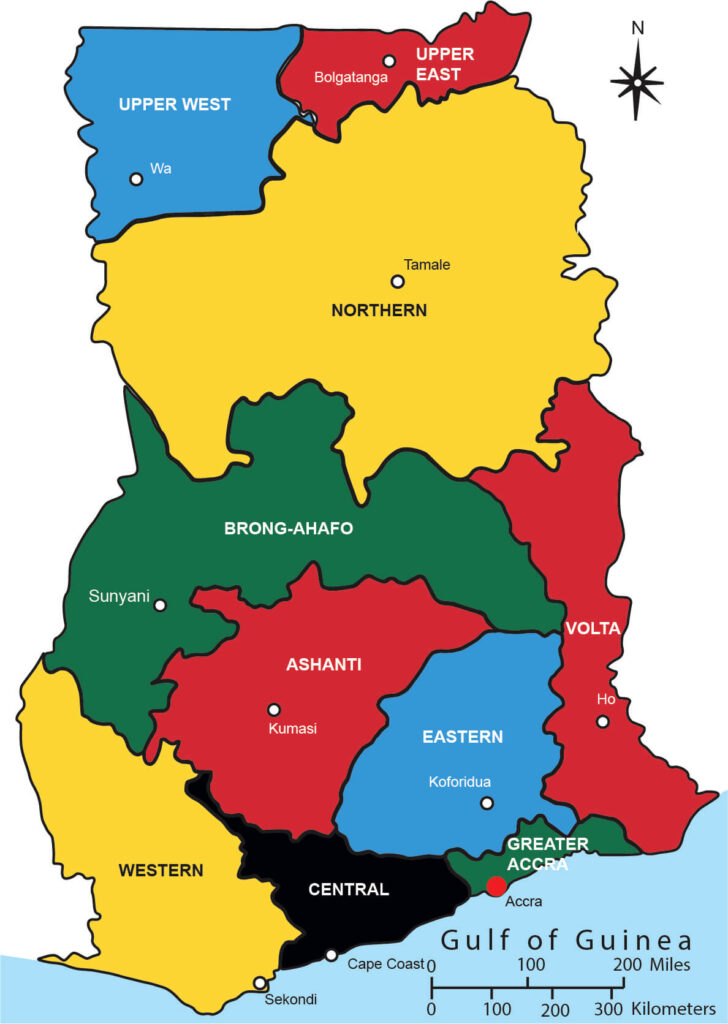
Map of Ghana Accra with 10 Major Cities.
Ghana is a country located in West Africa and is known for its vibrant culture, history, and diverse cities. Some of the major cities in Ghana include:
- Accra: Accra is the capital city of Ghana and the largest city in the country. It is the economic and administrative center of Ghana and is home to various government institutions, businesses, and cultural attractions. Accra is known for its bustling markets, beautiful beaches, and vibrant nightlife.
- Kumasi: Kumasi is the second-largest city in Ghana and is located in the Ashanti Region. It is known as the cultural capital of Ghana and is famous for its traditional Ashanti architecture, craft markets, and festivals. Kumasi is also home to the Ashanti king’s palace, the Manhyia Palace.
- Sekondi-Takoradi: Sekondi-Takoradi is a twin city located in the Western Region of Ghana. It is an important industrial and commercial center, especially for the country’s oil and gas industry. The city has a busy port and is known for its beaches, fishing industry, and lively entertainment scene.
- Tamale: Tamale is the largest city in northern Ghana and serves as the capital of the Northern Region. It is a major hub for trade and commerce in the northern part of the country. Tamale is known for its colorful markets, traditional mud houses, and vibrant festivals, such as the Fire Festival.
- Cape Coast: Cape Coast is a historic city located in the Central Region of Ghana. It was once the capital of the British Gold Coast and served as a major center for the transatlantic slave trade. Cape Coast is known for its colonial architecture, Cape Coast Castle (a UNESCO World Heritage Site), and beautiful beaches.
- Tema: Tema is a city located on the Gulf of Guinea coast, east of Accra. It is an industrial and commercial hub and is known for its busy seaport, which serves as Ghana’s major export gateway. Tema is also home to the Tema Oil Refinery and various manufacturing industries.
These are just a few examples of the major cities in Ghana. The country has many other towns and cities, each with its own unique characteristics, attractions, and cultural heritage. Here is the map I have produced in Illustrator for research purposes. You can download it FREE!!.
Why is Accra famous?
Accra is famous for several reasons:
- Capital city: Accra is the capital city of Ghana, making it the political, economic, and administrative center of the country.
- Cultural hub: Accra is known for its vibrant cultural scene. It is home to numerous cultural institutions, art galleries, museums, theaters, and music venues that showcase Ghanaian and African arts, music, and traditions.
- Historical significance: Accra has a rich historical background, particularly related to the colonial era and the transatlantic slave trade. Landmarks such as the Kwame Nkrumah Memorial Park, the Jamestown area, and the Ussher Fort recall the city’s history and attract visitors.
- Markets and shopping: Accra is renowned for its bustling markets, such as Makola Market and the Arts Centre. These markets offer a wide range of goods, including traditional crafts, textiles, fresh produce, and local cuisine.
Is Accra a beautiful city?
Accra can be considered a beautiful city in its own unique way. While beauty is subjective, Accra has its charms and attractions. The city offers a mix of modern infrastructure and traditional architecture, with a backdrop of beautiful beaches along the coast. The lively markets, vibrant street life, and colorful festivals add to the city’s charm. However, like any other bustling city, Accra also faces challenges related to traffic congestion and infrastructure development.
Which part is Accra in Ghana?
Accra is located on the southeastern coast of Ghana, along the Gulf of Guinea. It is situated in the Greater Accra Region, which is one of the ten administrative regions of Ghana. Accra stretches from the coastline inland and is bordered by the Atlantic Ocean to the south.
What is Ghana best known for?
Ghana is known for several notable aspects:
- Cocoa production: Ghana is one of the world’s largest producers of cocoa beans, which are the key ingredient in chocolate. The country’s cocoa industry is highly significant to its economy and international trade.
- Peaceful democracy: Ghana is often referred to as one of the most stable and democratic countries in Africa. It has a history of peaceful transitions of power through democratic elections, making it a model for good governance in the region.
- Rich cultural heritage: Ghana is known for its diverse cultural heritage, including traditional music, dance, and festivals. The country is home to numerous ethnic groups, each with its own traditions, costumes, and languages.
- Hospitality and friendliness: Ghanaians are renowned for their warmth, hospitality, and friendliness towards visitors. The concept of “Ghanaian hospitality” is often highlighted by tourists who experience the welcoming nature of the local people.
- Natural attractions: Ghana boasts a variety of natural attractions, including national parks, wildlife reserves, waterfalls, and pristine beaches. Places like Kakum National Park, Mole National Park, and the beaches of Cape Coast and Ada are popular destinations for nature lovers and tourists.
The Ghana map serves as a key resource, providing insights into Accra’s intricate details. Specifically, the Accra city map offers a closer look at its location, geography, and neighboring regions.
Accra, the bustling capital of Ghana, is strategically positioned on the Gulf of Guinea coast. Its favorable location attracts locals and tourists alike, offering access to beautiful beaches and stunning ocean views. The Accra city map showcases this coastal charm and helps visitors navigate its streets and neighborhoods with ease.
The geography of Accra is diverse, boasting a combination of coastal plains and rolling hills. The Accra topography, illustrated on the map, allows explorers to understand the city’s natural landscape and plan their adventures accordingly. From pristine beaches to lush green spaces, Accra has much to offer in terms of scenic beauty.
As one explores Accra, the regions of Ghana become apparent. The Ghana map not only highlights Accra but also provides a broader perspective on the country’s various regions. Each region exhibits its own unique characteristics and cultural heritage, making Ghana an incredibly diverse destination.
Accra is adorned with landmarks that tell stories of its rich history and culture. The Accra landmarks, indicated on the map, serve as gateways to the city’s past. From the historic Jamestown area to the Kwame Nkrumah Memorial Park, these sites captivate visitors and offer a glimpse into Accra’s identity.
Navigating Accra’s streets can be an adventure in itself. The Accra city map showcases the intricate network of streets and roads, enabling travelers to move around the city efficiently. From the bustling markets of Makola to the serene neighborhoods of Labadi, the map guides visitors through Accra’s vibrant tapestry.
For a panoramic view of Accra, the Accra satellite view provides a unique perspective. The satellite imagery showcases the city’s layout and allows for a better understanding of its spatial arrangement. It assists in identifying key landmarks, neighborhoods, and major transportation routes.
Speaking of transportation, the Accra map plays a crucial role in planning journeys within the city. Accra’s transportation system encompasses various modes, including taxis, buses, and tro-tros (shared minibusses). The Accra map helps travelers locate key transportation hubs and choose the most suitable routes for their explorations.
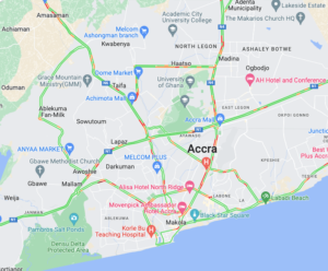
Accra is divided into different districts, each with its own character and charm. The Accra districts, illustrated on the map, offer insights into the city’s diverse neighborhoods. From the vibrant Osu district to the historic district of Jamestown, Accra’s districts provide unique experiences and attractions.
Accra is teeming with points of interest that cater to different tastes and interests. The Accra points of interest, marked on the map, guide visitors to renowned tourist attractions, cultural hotspots, and hidden gems. Whether it’s visiting the National Museum, exploring the vibrant markets, or enjoying the lively nightlife, Accra offers something for everyone.
In conclusion, the map of Ghana Accra serves as an indispensable tool for exploring the captivating city. From understanding its location and geography to discovering its neighborhoods, landmarks, and points of interest, the map provides valuable insights and aids in creating unforgettable experiences. So, grab a map, embrace the spirit of adventure, and embark on a journey through Accra, the heart of Ghana.
Download The Map of Ghana Accra, Africa, and More:
Are looking for a Upazila map of Bangladesh?
Here you can download the HD-quality map of Upazila in Bangladesh.
