Welcome!
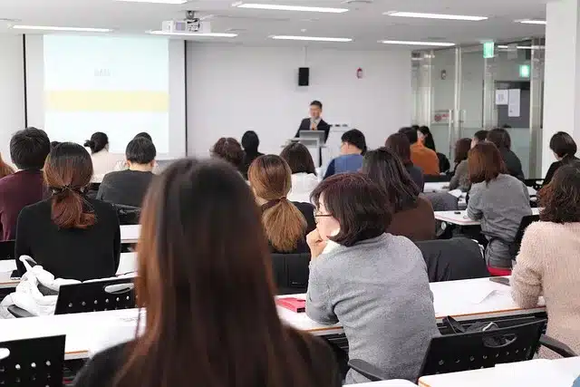
I have prepared all the lectures for the students of the Faculty of Environmental Science and Disaster Management, Patuakhali Science and Technology University, Bangladesh.

Welcome!
I have prepared all the lectures for the students of the Faculty of Environmental Science and Disaster Management, Patuakhali Science and Technology University, Bangladesh.
[প্রতিটি কোর্স এর বিষয়ে সমস্ত লেকচার গুলো উপরের মেনু থেকে জানতে পারবেন] [Learn more from the Manu above]
 1. Lecture (DRE 5204) Applied Hydrology and Water Engineering
What you will learn-
Introduction: Concepts and definition of hydrology, hydrologic cycle, hydrological budget, concepts of stream ordering, drainage system and hydro stratigraphic layers. Porosity and permeability of subsurface rock materials. Surface and groundwater interactions. Measurement and analysis of hydrological parameters: Reynolds transport theorem, continuity equation, open channel flow, porous medium flow, energy balance transport process, drainage basin characteristics; measurement of precipitation/rainfall, rain gauge networks, measurement of evaporation and evapo-transpiration, surface and subsurface run-off, measurement of stream discharge, interception and depression storage, infiltration of soil moisture, ground water base flow. Water resources hydrology: Hydrology of water resources, rural and urban water supply systems, water impoundments, groundwater rise and fall and their hydrological impact, hydrological impact of water pollution. River flood and bank erosion: Hydrologic aspects of flood and river bank erosion, management of flood and river bank erosion. Drought: Hydrological impacts of drought, water resources management plan for drought. Aridity index and water balance study for a catchment area. Desertification: Causes and impacts on hydrologic cycle, policy and plan for mitigation. Sea level rise: Potential hydrologic effects and their assessment, mitigation measures. Coastal erosion and marine pollution: Hydrology of coastal erosion, embankments to protect erosion. Sources of marine pollution and its hydrological impact. Cyclone, tidal surge and Tsunami: Hydrological impacts of cyclones, tidal surges and Tsunami in coastal areas. Mitigation measures.
You will learn-
Earthquake Engineering: Concept of Seismology and earth structure Earthquake: Causes, characteristics and distribution of earthquake, seismic waves, Snell’s law, geological faults, geological structures and maps, stratigraphic sections. Seismogenic faults: Concept and History of earthquakes in Bangladesh. Earthquake management: Global earthquake zones, nature and effects of earthquake hazards, prediction, warning, planning and mitigation policies of earthquake. Earthquake preparedness, response and recovery. Earthquake source mechanism: Seismic instrumentation, installation, operation of seismographic stations, operation of a seismographic network, measuring earthquakes-location, magnitude and intensity. Soil properties related to earthquake: Classification of soil, stress and strain, principle of effective stress, calculating stresses that influence soil behavior, calculating water flow through ground, and understanding the effects of seepage on the stability of structures, determining soil deformation parameters, and calculating settlement magnitude and rate of settlement, specifying soil compaction requirements, field and laboratory tests. Physico-mechanical properties of rocks: Determination of physic-mechanical properties of intact rock and rock mass, rock discontinuities, in situ stresses and failure mechanisms in rocks. Engineering properties of soft, weak and compressible deposits, principles of treatment-loading (static and dynamic), accelerated flow, reinforcement, vertical drains granular piles, soil nailing-anchors etc. Dynamics of earthquake: Fundamentals of dynamic behaviour of single degree of freedom with or without damping. Mitigation strategy to resists earthquake loading. Methodologies of seismic analysis: Application of seismic analysis methodologies in the design and assessment of geotechnical structures, fundamental components of earthquake risk assessments from estimation of probable earthquake ground shaking in an area, to the consequent building damage, human casualties and economic losses. b. Urban Disaster Management: Urban disaster management principles: Concept of city and Urbanization. Classification of urban natural and human induced disasters, Characteristics of urban disasters, Analogy of over damage and over infection, Effect of population density on urban natural disaster, Scenario of amplification of urban natural disasters, Common types of urban disasters and it’s scenario towards catastrophe. The Disaster Crunch Model, Urban disaster management tools for developing and implanting a city wise disaster risk reduction agenda. Approaches of modern city to recover urban disasters. Urban Hazards and safety measures: Hazards associated with structural damages, geotechnical hazards, hazards due to earthquake, cyclone, fire, terrorist attack, Heat wave generation etc., damage in infrastructures, damages associated with service lines and life lines (water, gas pipelines, electrical lines, telephone lines etc.) , Damages to energy and electric power, telecommunication, water distribution and environmental services, safely against different type of hazards, rehabilitations, health aspects. Earthquake related hazards: maintenance of appropriate building code, site selection for construction of infrastructures, Risk of Morbidity and Mortality, Injury Prevention, Public Health Interventions, A Case Study of Earthquake Risk Assessment in Cartago, Costa Rica. Urban flood modeling and disaster risk management: Urban Flood Modelling and Evaluation of Flood Risks, Structural and Non-structural Urban Flood Management Measures, Managing Urban Flood Disasters. Urban disaster and globalization: Urban area and urban hazards, Globalization and the business cycle, Disaster situation in urban areas, Disaster impacts and mechanisms. Prediction of the common urban disasters and risk assessment due to an upcoming disaster, Preparedness and Responding to urban disasters, agency coordination during response. Disaster Survival Skills for the Urban Environment, Urban Resilience and Disaster Vulnerability in the Asia-Pacific Region, Bangladesh Urban Disaster Mitigation Project (BUDMP) GIS Applications in Urban Disaster Prevention Spatial System.
Course Content:
Introduction : Definition of statistics, historical development of statistics, Uses of statistics in different field. Limitation of statistics, review of basic statistics, philosophy and purpose of using statistics. Variable and frequency distribution: Population, sample, data, variables, frequency and frequency distribution. Graphical representation of frequency distribution Central tendencies and its measurement: Definition of central tendency. Different measurement of central tendency. Characteristics of ideal measures of central tendency, Graphical determination of quartiles and mode. Empirical relationship among arithmetic mean, median and mode. Dispersion, nature and shape of frequency distribution: Definition of dispersion, different measurement of dispersion, characteristics of an ideal measure of dispersion, moment, skewness and kurtosis. Probability and theory of probability: Definition of probability, elementary set theory {notation, operation and algebra}, Laws of probability. Random variables and probability distribution: Random variables, probability functions, probability density functions. Probability distribution functions, Binomial distribution, and normal distribution Regression and correlation: Bivariate, linear regression, correlation, rank correlation, multiple and partial correlation and regression, regression methods (simple linear, multiple linear and non-linear) Design of experiments: Data Analyses using different design of experiments and significance tests, CRS, RCBD and LSD Assignment: Data analyses technique using statistical tools, significance test T-test and X test.
Course Content:
Earthquake Engineering: Concept of Seismology and earth structure Earthquake: Causes, characteristics and distribution of earthquake, seismic waves, Snell’s law, geological faults, geological structures and maps, stratigraphic sections. Seismogenic faults: Concept and History of earthquakes in Bangladesh. Earthquake management: Global earthquake zones, nature and effects of earthquake hazards, prediction, warning, planning and mitigation policies of earthquake. Earthquake preparedness, response and recovery. Earthquake source mechanism: Seismic instrumentation, installation, operation of seismographic stations, operation of a seismographic network, measuring earthquakes-location, magnitude and intensity. Soil properties related to earthquake: Classification of soil, stress and strain, principle of effective stress, calculating stresses that influence soil behavior, calculating water flow through ground, and understanding the effects of seepage on the stability of structures, determining soil deformation parameters, and calculating settlement magnitude and rate of settlement, specifying soil compaction requirements, field and laboratory tests. Physico-mechanical properties of rocks: Determination of physic-mechanical properties of intact rock and rock mass, rock discontinuities, in situ stresses and failure mechanisms in rocks. Engineering properties of soft, weak and compressible deposits, principles of treatment-loading (static and dynamic), accelerated flow, reinforcement, vertical drains granular piles, soil nailing-anchors etc. Dynamics of earthquake: Fundamentals of dynamic behaviour of single degree of freedom with or without damping. Mitigation strategy to resists earthquake loading. Methodologies of seismic analysis: Application of seismic analysis methodologies in the design and assessment of geotechnical structures, fundamental components of earthquake risk assessments from estimation of probable earthquake ground shaking in an area, to the consequent building damage, human casualties and economic losses. b. Urban Disaster Management: Urban disaster management principles: Concept of city and Urbanization. Classification of urban natural and human induced disasters, Characteristics of urban disasters, Analogy of over damage and over infection, Effect of population density on urban natural disaster, Scenario of amplification of urban natural disasters, Common types of urban disasters and it’s scenario towards catastrophe. The Disaster Crunch Model, Urban disaster management tools for developing and implanting a city wise disaster risk reduction agenda. Approaches of modern city to recover urban disasters. Urban Hazards and safety measures: Hazards associated with structural damages, geotechnical hazards, hazards due to earthquake, cyclone, fire, terrorist attack, Heat wave generation etc., damage in infrastructures, damages associated with service lines and life lines (water, gas pipelines, electrical lines, telephone lines etc.) , Damages to energy and electric power, telecommunication, water distribution and environmental services, safely against different type of hazards, rehabilitations, health aspects. Earthquake related hazards: maintenance of appropriate building code, site selection for construction of infrastructures, Risk of Morbidity and Mortality, Injury Prevention, Public Health Interventions, A Case Study of Earthquake Risk Assessment in Cartago, Costa Rica. Urban flood modeling and disaster risk management: Urban Flood Modelling and Evaluation of Flood Risks, Structural and Non-structural Urban Flood Management Measures, Managing Urban Flood Disasters. Urban disaster and globalization: Urban area and urban hazards, Globalization and the business cycle, Disaster situation in urban areas, Disaster impacts and mechanisms. Prediction of the common urban disasters and risk assessment due to an upcoming disaster, Preparedness and Responding to urban disasters, agency coordination during response. Disaster Survival Skills for the Urban Environment, Urban Resilience and Disaster Vulnerability in the Asia-Pacific Region, Bangladesh Urban Disaster Mitigation Project (BUDMP) GIS Applications in Urban Disaster Prevention Spatial System.
Course Content:
Identification of rocks and minerals: Identification and Determination of various kinds of igneous, sedimentary and metamorphic rocks and minerals. Identification of primary and secondary waves: earthquake focal mechanism, identification of primary, secondary waves and arrival times of seismic waves, determination of magnitude, intensity and location of earthquake epicenter. Preparation of earthquake hazards map: Identification of stratigraphic layers, preparation of lithologs from geophysical data. Identification of subsurface faults and fractures for the determination of possible earthquake sources from seismic data. Application of seismic analysis methodologies in the design and assessment of geotechnical structures. Mathematical problems on geotechnical properties of soft, weak and compressible deposits. Exercise for the determination of i. Porosity and permeability, ii. soil density and volume relations, iii. water content and degree of saturation iv, bearing capacity of earth materials. Determination of stress and its related issues: Uses of alter berg limit for describing the consistency of soil, determination of stress, shear strength, and compressibility of soil and rock materials. calculating stresses that influence soil behavior, calculating water flow through ground, and understanding the effects of seepage on the stability of structures, determining soil deformation parameters, and calculating settlement magnitude and rate of settlement.
Course Content
Introduction: Definition and functions of management, evolution of management thoughts, historical foundations of management and the roles of management personnel, difference between managers and entrepreneurs. Communication and interpersonal skills: Communication process, computer networks, video conferences, and telecommuting for organizational communication. Foundations of planning: Principles, objectives and types of planning; role of policies, rules and programs. Organizational design: Centralized and decentralized organization, delegation, basic departmentalization formats, effective organizational development program; foundations of organizational control (learning organization, restructuring, characteristics of organizational cultures). Human resource management: Essential components of human resource, the biggest human resource concerns of today’s managers, importance of performance appraisals and their effective use. Motivating and rewarding employees: Significance of cohesiveness, roles, norms, and ostracism in relation to the behaviors of group members; stages of group development, groupthink/interest, trust, understanding work teams. Strategic management: Strengths, weaknesses, opportunities and threats (SWOT) analyses; types of forecasts and steps in strategic management. Foundations in decision making: Basic steps of creative problem solving process; risk, contingency, management, programmed and non-programmed decisions, decision making process. Managers and management in the 21st century: Managing change and innovation, changing political-legal environment affecting management practices, the challenges and opportunities of diversified workforce, seven major changes shaping the 21st century workforce. Corporate social responsibility: Arguments for and against corporate social responsibility, cultural and social changes influencing management decisions, ethical behavior in management, how managers can become more responsive to social issues. Managerial ethics.
Introduction: Definition of environmental geophysics, methods employed, scopes of various geophysical methods. Applications to groundwater and hydrogeology, applications to environmental assessment and remediation. Seismic theory of elasticity and wave motion: Seismic velocity, classification of electrical methods, electrical properties of earth materials, elementary theory of resistivity method, resistivity field survey equipments, field procedure and data presentation. Role of geophysical methods in environmental studies: Mineral and petroleum exploration-gravity and magnetic, seismic, electrical and electromagnetic and geophysical well logging. Application of gravity and magnetic methods: Identification of landfill, to the identification of underground cavities and tunnels. Application of geophysical methods: Identification of buried faults, fractures to delineate earthquake prone zones, identification of upcoming volcanic activity, identification of landslide prone areas. Application of geoelectrical and seismic methods: Investigation of saline water intrusion in coastal aquifer, landfill, oil contamination of groundwater, groundwater pollution from waste disposal sites, mine works etc.
Course Content
Introduction: Definition, objectives, importance and types, methodology and limitations of research Research design: Features of good design, concept and development of research plan: Sampling design–sampling strategy, methodology and types of design of the program, sampling and survey and census, variables and hypothesis, measurement and its levels, reliability and validity, index construction, scales, social indicators, random assignments, design logic, internal and external validity, sampling, survey methods, analyzing quantitative data. Measurement and scaling techniques: Measurement and its levels; reliability and validity; index construction; testing hypothesis; choosing statistical tests, analysis, simulation, and interpretation Methods of data collection: Primary data, selection of appropriate data, data collection techniques: qualitative tools in data collection: census, survey and sampling procedures; guidelines for interviewing, Social and Participatory Methodologies in Peoples’ Participation: Quantitative tools in data collection: un-structured interview; ethnographic research; observation and participant-observation method; case studies, PRA & RRA; psychological approach in assessing trauma, anxiety, stress and strains; ethical issues in disaster research; ethno-methodology; conversation analysis; discourse analysis; positivism; emotionalism. Data processing and analysis : Problems, types statistics, interpretation of results, graphical representation and tabulation, Manuscript preparation, rules of quotation and bibliography Report writing: Scientific reports, reviews, short communication, case studies, web page, booklet and leaflet. Qualitative Research Methodology: The qualitative orientation and characteristics of qualitative research, ethnography, historical comparative research, and analyzing qualitative data. final consideration: ethics and value freedom in research, research proposal and reports, research plan assignment.
This course is designed for the beginner to advanced level of students especially for Undergraduate to Graduate students for the University Degree in Bangladesh or Abroad and specially designed for the students of the Department of Disaster Resilience and Engineering of Patuakhali Science and Technology University.

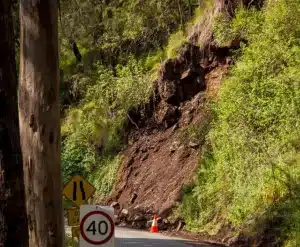
Download all the class lectures in PDF versions for the topics of Landslide.
Suggestion:
1. What is a landslide?
2. What are the main ways that materials on a slope may fail?
3. What is the safety factor, and how is it defined?
4. Differentiate between rotational slides (slumps) translational slides and shallow slips.
5. How does the slope angle affect the incidence of landslides?
6. What are the three ways that vegetation is important in slope stability?
7. How may spontaneous liquefaction occur?
8. Why does time play an important role in landslides?
9. What is the main lesson learned from the Vaiont Dam disaster?
10. How might the process of urbanization increase or decrease the stability of the slope
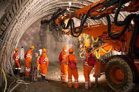
Our Services on Disaster in Mining Exploration and Management
This text briefly introduces visitors to your main services.
List of Lectures: Visit from the Manu

Our Services on Sustainable Water Resource
List of Lectures: Visit from the Manu
Sustainable Water Resources in Bangladesh are listed Here
Where to apply for the Internship and find the Internship Guide
♥ Dr. Raman Kumar Biswas, Ph.D.
♥ Professor
Dept. of Disaster Resilience and Engineering
Faculty of Environmental Science and Disaster Management,
Patuakhali Science and Technology University, Dumki-8602, Patuakhali
Copyright © 2025 Colorgeo.com
ইবুক ডাউনলড করে পড়ুন খুব সহজে। Dismiss