Assignment on Bedrock Granite
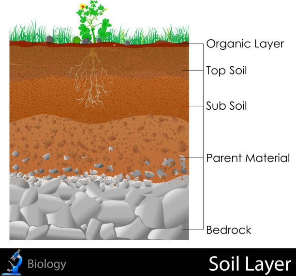
Bedrock penitration is one of the critical site investigation procedures for seismic hazard analysis and underground developments that may encounter varying rock formations. The rock that underlies looser surface material. Bedrock is the solid, intact part of the earth’s crust, the outer layer 20-25 miles thick that rests on the earth’s mantle.
What is Bedrock Granite?
Bedrock Granite is formed due to the use pressure and temperature below the ground from the magma. When magma solidify it forms a granite rock. Bedrock Granite is basically igneous rock. Granite rock is very durable and long-lasting. Below the soil surface there might be sedimentary rock like limestone or igneous rock like granite and other metamorphic rock as a bedrock.
Bedrock Granite is very good for constructing a building on the Bedrock. Because Granite is very hard rock and any construction on that Bedrock surface is really best choice and the structure will be long-lasting and earthquake safety.
Alternatively we can decide limestone or metamorphic rock in replace of Bedrock Granite.
What is granite?
Granite is a hard igneous rock. Granite is very beautiful Rock. The color of granite very from black to white or any other color also we can find like blue granite.
The price?
The price of granite rock very depends on the fracture porosity and color of the Rock. The beautiful white color containing shining Mica is expensive.
How can we identify best granite rock?
Weekend identify chronic Rock using a tablespoon heating on the granite rock. If the sound is ringing then the quality of the rock is best whereas the sound like click is not so good and cheaper granite rock. The color of granite rock also variable and price dependent.
Who are the most producing country of granite rock.
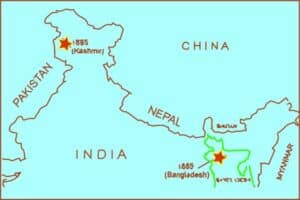
India is the largest producer of granitic Rock. More than 80% of the world’s Granite demand is exported from India. Although there are many country who are exporting granite like China Italy.
How to use granite rock in our daily life?
Granite countertop at the kitchen makes the kitchen very beautiful. As a counter top of the kitchen we can use granite slab. Granite countertop is very luxurious and beautiful and comfortable to use. It’s very long lasting more than 100 years it can last if we maintain the kitchen countertop very regularly.
In most places in Mine, the bedrock is concealed by a thin layer of unconsolidated sediment, soil, and vegetation.
An exposed portion of bedrock is often called an outcrop.
The various kinds of broken and weathered rock material, such as soil and subsoil that may overlie the bedrock are known as the bedrock beneath the soil cover regolith is also known as engineering geology and its identification by digging.
Weathering may be physical or chemical and alters the structure of the rock and may cause it to erode and or alter over time-based on the interactions between the mineralogy and its interactions.
Noise seismic data from Cape Cod produced clear, easily identified resonance frequency peaks. The interpreted depth and geometry of the bedrock surface correlate well with boring data and previously published seismic refraction surveys.
Conversely, the ambient noise seismic data from eastern Nebraska produced subtle resonance frequency peaks, and correlation of the interpreted bedrock surface with depths from borings is poor, which may indicate a low acoustic impedance contrast between the weathered sedimentary rock and overlying sediments and the effect of wind noise on the seismic records.
Local estimates of bedrock depth likely could be improved through the development of regional or study‐area‐specific regression equations relating resonance frequency to
depth.
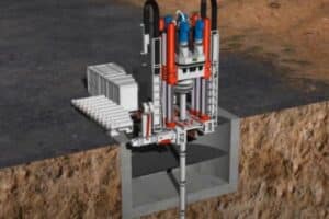
To assess the subsurface strata and to locate the particular depth of rock, most of the site investigation practices typically follow conventional programs which involve traditional drilling, sampling, and laboratory testing as well as specific in-situ test.
The new empirical correlation is established between the natural frequency of the ground calculated from the MM and the bedrock
depth from conventional borehole drilling. Understanding the global pattern of
underground boundaries such as groundwater and bedrock occurrence are of continuous interest to Earth and Geosciences.
More assignments in Geophysics visit ionosphere, oceanography, etc.


